
📋 Table of Contents
- Introduction — Why Should You Care?
- What is ENSO?
- Normal (Neutral) Ocean & Atmosphere Conditions
- What is El Niño?
- What is La Niña?
- El Niño vs La Niña — Side-by-Side Comparison
- How Scientists Measure and Predict ENSO
- Notable Historical Events
- Impact on India & South Asia
- ENSO and Climate Change
- Economic Impact
- Quick Facts & Numbers
- Frequently Asked Questions
- Conclusion
1. Introduction — Why Should You Care?
Imagine waking up one morning to news that farmers in India are bracing for drought, floods are battering Peru, Australia is struggling with wildfires, and fish are disappearing off the coast of South America — all at the same time, all caused by the same invisible force in the Pacific Ocean. That force has a name: El Niño.
Its counterpart, La Niña, is equally powerful but works in the opposite direction — bringing drenching rains to places that El Niño dries out, and sending cold, dry winds where El Niño created warmth.
Together, El Niño and La Niña are the two phases of a giant climate engine called ENSO (El Niño–Southern Oscillation). This engine has been running for thousands of years, but humans only began to understand it in the 20th century. Today, it is the single most important climate pattern on Earth after the seasons themselves — and it affects the food you eat, the water you drink, the air you breathe, and the economy of your country.
This blog explains everything about El Niño and La Niña in simple, clear language — what they are, how they form, what they do to weather worldwide, their history, their link to climate change, and what the future holds.
2. What is ENSO?
ENSO stands for El Niño–Southern Oscillation. It is a naturally occurring climate pattern involving the interaction between the surface temperature of the tropical Pacific Ocean and the atmosphere above it.
The word oscillation means "back and forth." ENSO oscillates between three states:
ENSO cycles typically last 9 to 12 months each, though some events extend to 2 years. A complete cycle — from El Niño to Neutral to La Niña and back — takes roughly 2 to 7 years. This irregular rhythm makes ENSO fascinating and challenging to predict.
The "Southern Oscillation" part of the name refers to the see-saw pattern of atmospheric pressure between the eastern and western Pacific — specifically between Tahiti in the east and Darwin, Australia in the west. When pressure is high in one area, it tends to be low in the other.
3. Normal (Neutral) Ocean & Atmosphere Conditions
To understand El Niño and La Niña, you first need to understand what the Pacific Ocean looks like on a normal day. Think of the Pacific as a giant bathtub. In normal conditions, the climate system is balanced in a very specific way.
The Trade Winds
Near the equator, the atmosphere is always in motion. Trade winds blow from east to west — from the cooler coasts of South America toward Asia and Australia. These winds are consistent, powerful, and absolutely central to Earth's tropical climate.
The Warm Water Pool
As the trade winds blow from east to west across the Pacific, they push warm surface water along with them. Over time, this creates a massive pool of warm water in the western Pacific — near Indonesia, the Philippines, and Australia. This pool can be up to 60 meters deep and is often 8°C (14°F) warmer than the eastern Pacific.
Upwelling on the East Coast
Meanwhile, on the other side of the Pacific — near Peru and Ecuador — the trade winds push surface water away from the coast. This creates a process called upwelling: cold, nutrient-rich water from the deep ocean rises to replace the surface water that was blown away. This cold upwelling keeps the eastern Pacific cool and supports rich marine ecosystems and fisheries.
The Walker Circulation
The warm western Pacific heats the air above it, causing that air to rise, form clouds, and bring heavy rain to places like Indonesia. The air then travels east at high altitude, cools, and sinks down over the cool eastern Pacific — bringing dry conditions to South America's western coast. This loop of air movement is called the Walker Circulation, named after British meteorologist Sir Gilbert Walker, who first described it in the 1920s.
When this balanced system is disrupted — when the trade winds falter or reverse — El Niño or La Niña is born.
4. What is El Niño?
The name El Niño comes from Spanish and means "The Little Boy" or "The Christ Child." Peruvian fishermen gave it this name centuries ago because the warm ocean current that disrupted their fishing typically arrived around Christmas time — a nod to the birth of Jesus Christ.
Scientifically, El Niño is defined as a period when sea surface temperatures (SST) in the central and eastern tropical Pacific Ocean rise 0.5°C or more above the long-term average for at least five consecutive three-month periods. In major events, temperatures can rise by 2–3°C or even higher.
How Does El Niño Form?
El Niño begins with a weakening of the trade winds. Scientists do not yet fully understand what triggers this weakening — it may be a random fluctuation in the atmosphere, deep-ocean waves, or a combination of factors. But once the trade winds weaken, a chain reaction begins:
Step 1 — Trade winds weaken
The east-to-west winds across the Pacific slow down. Some may even reverse direction temporarily.
Step 2 — Warm water spreads eastward
Without strong winds holding it in the west, the warm water pool begins to slosh eastward across the Pacific — like tilting a bathtub and watching the water slide to the other end.
Step 3 — Upwelling weakens
As warm water covers the eastern Pacific, it blocks the cold upwelling near Peru and Ecuador. Sea surface temperatures in the eastern Pacific rise dramatically.
Step 4 — Walker Circulation reverses/weakens
The atmosphere responds to the warm eastern Pacific. Rain and rising air shift eastward. The normal Walker Circulation loop is disrupted or reversed.
Step 5 — Global weather changes
The repositioned heat and rainfall affect jet streams and weather patterns across the entire globe. El Niño has fully arrived.
Global Effects of El Niño
El Niño's effects are felt worldwide, though they vary significantly by region. Here are its most well-documented impacts:
South America (Peru, Ecuador, Brazil): The western coast of South America experiences heavy rainfall and catastrophic flooding. Rivers overflow, landslides occur, and cities are inundated. In contrast, northeast Brazil typically suffers drought. The normally rich Peruvian fishing industry collapses as warm water drives away cold-water fish like anchovies.
North America: The southern United States tends to receive above-normal rainfall during El Niño winters, which can cause flooding in California and the Gulf Coast states. Northern states and Canada often experience milder winters. The Atlantic hurricane season tends to be quieter during El Niño years, as strong upper-level winds (wind shear) suppress hurricane formation.
Australia & Southeast Asia: Australia, Indonesia, the Philippines, and surrounding regions typically experience drought, reduced rainfall, and increased risk of wildfires. The devastating Australian bushfires of 1982–83 and 1997–98 were strongly linked to El Niño. Indonesia's forests are prone to burning, releasing massive amounts of carbon into the atmosphere.
Africa: Southern Africa often sees reduced rainfall and drought during El Niño, with severe consequences for agriculture in countries like Zimbabwe, Zambia, and South Africa. East Africa, surprisingly, often receives more rainfall during El Niño.
South & Southeast Asia (India, Bangladesh, Sri Lanka): The Indian monsoon — which delivers over 70% of India's annual rainfall — is often weakened during El Niño years. This leads to drought conditions, reduced crop yields, water shortages, and economic stress. We'll discuss this in detail in the India section.
5. What is La Niña?
La Niña — meaning "The Little Girl" in Spanish — is the opposite phase of El Niño. It is defined as a period when sea surface temperatures in the central and eastern tropical Pacific drop 0.5°C or more below the long-term average for at least five consecutive overlapping three-month periods.
La Niña is sometimes called the "anti-El Niño" because it reinforces and exaggerates the normal Pacific weather patterns rather than disrupting them. If El Niño is a storm breaking normal patterns, La Niña is a gale pushing those patterns to the extreme.
How Does La Niña Form?
La Niña often follows an El Niño event, though not always. After El Niño weakens and warm water retreats from the eastern Pacific, the system can "overcorrect." The trade winds, freed from El Niño's suppression, return with extra strength. This is how La Niña begins:
Step 1 — Trade winds strengthen
Trade winds intensify well beyond their normal strength, pushing even more warm surface water toward the western Pacific.
Step 2 — Warm water pools in the west
The western Pacific warm pool grows larger and deeper than usual, piling up near Australia and Southeast Asia.
Step 3 — Enhanced upwelling in the east
Stronger winds drive more vigorous upwelling along the South American coast, bringing up very cold deep water. Eastern Pacific cools significantly.
Step 4 — Walker Circulation intensifies
The temperature contrast between the very warm western Pacific and the very cool eastern Pacific strengthens the Walker Circulation dramatically.
Step 5 — Extreme weather worldwide
La Niña pushes rainfall and dry spells in the opposite direction to El Niño, often causing more extreme versions of normal weather patterns.
Global Effects of La Niña
Australia & Southeast Asia: La Niña typically brings heavy rainfall, flooding, and cooler temperatures to Australia, Indonesia, and the Philippines. The 2010–2011 La Niña caused catastrophic flooding across Queensland, Australia, affecting an area larger than France and Germany combined. Southeast Asia also receives abundant monsoon rains during La Niña years.
South America: The western coast of South America (Peru, Chile) experiences dry, cool conditions — the opposite of El Niño's flooding. Meanwhile, Colombia and northern South America may see increased rainfall.
North America: The northern United States and Canada tend to see colder-than-average winters during La Niña, while the southern US becomes drier and warmer. The Gulf Coast states face higher wildfire risk. La Niña is also associated with more active Atlantic hurricane seasons — the reduced wind shear allows hurricanes to develop and strengthen more easily.
Africa: Southern Africa typically receives above-normal rainfall during La Niña. East Africa often faces drought. West Africa's rainy season may be enhanced, benefiting agriculture.
India & South Asia: La Niña generally enhances the Indian monsoon, bringing above-normal rainfall. While this is largely beneficial for agriculture, it can also lead to flooding in low-lying areas. La Niña winters can bring more intense cold waves to northern India.
6. El Niño vs La Niña — Side-by-Side Comparison
| Feature | 🔥 El Niño | ❄️ La Niña |
|---|---|---|
| Eastern Pacific Temp | Warmer than normal (+0.5°C to +3°C) | Cooler than normal (−0.5°C to −2°C) |
| Trade Winds | Weakened or reversed | Stronger than normal |
| Walker Circulation | Weakened or reversed | Strengthened |
| Warm Water Pool | Moves eastward to central/eastern Pacific | Concentrated in western Pacific |
| Upwelling (Peru coast) | Suppressed | Enhanced |
| Australia/Indonesia | Drought, fires | Heavy rain, floods |
| Peru/Ecuador | Heavy rain, floods | Drought, dry conditions |
| Indian Monsoon | Often weakened (drought risk) | Often enhanced (flood risk) |
| Atlantic Hurricanes | Fewer (stronger wind shear) | More (weaker wind shear) |
| Global Temperature | Raises global average temperature | Lowers global average temperature slightly |
| Peruvian Fisheries | Severely disrupted | Enhanced (more upwelling, more nutrients) |
| Southern US | Wetter winters | Drier, warmer winters |
7. How Scientists Measure and Predict ENSO
Predicting El Niño and La Niña even a few months in advance is one of the great achievements of modern climate science. It requires a global network of instruments, satellites, and supercomputers working together.
The Niño Regions
Scientists divide the tropical Pacific into numbered monitoring zones called Niño Regions:
- Niño 1+2: Far eastern Pacific, near Peru and Ecuador — the first place affected by warming.
- Niño 3: Central-eastern Pacific — the traditional core monitoring zone.
- Niño 3.4: The most widely used index, covering the central Pacific. This region's temperature anomaly determines whether an official El Niño or La Niña is declared.
- Niño 4: Central-western Pacific — useful for tracking El Niño Modoki (see below).
The ONI Index
The primary tool for classifying ENSO events is the Oceanic Niño Index (ONI), maintained by NOAA (National Oceanic and Atmospheric Administration, USA). It measures the 3-month running mean of sea surface temperature anomalies in the Niño 3.4 region:
The TAO/TRITON Buoy Array
The backbone of Pacific Ocean monitoring is the TAO/TRITON array — a network of about 70 moored ocean buoys stretching across the tropical Pacific. These buoys continuously measure ocean temperatures at various depths, wind speed, wind direction, air temperature, and humidity. Data is transmitted in real time to scientists around the world.
Satellite Monitoring
Space-based instruments like the Jason satellite series (operated by NASA and France's CNES) measure the height of the sea surface with extraordinary precision. During El Niño, sea level in the eastern Pacific rises as warm water accumulates — satellites can detect these changes from space. Other satellites measure sea surface temperatures globally, providing a complete picture of the Pacific's thermal state.
Climate Models and Prediction
Scientists use complex computer models — some running on supercomputers processing trillions of calculations per second — to simulate the ocean-atmosphere system and forecast ENSO months in advance. Major forecasting centres include NOAA in the USA, the European Centre for Medium-Range Weather Forecasts (ECMWF), the Bureau of Meteorology in Australia, and the India Meteorological Department (IMD).
Typically, El Niño and La Niña can be predicted with reasonable skill 6–9 months ahead. However, there is a period called the "spring predictability barrier" (around March–May) when forecasts become less reliable, possibly because the ocean-atmosphere coupling is weaker at that time of year.
El Niño Modoki — A Different Kind of El Niño
Not all El Niño events are the same. Scientists have identified a variation called El Niño Modoki (Modoki means "similar but different" in Japanese). In a Modoki event, warming occurs in the central Pacific rather than the eastern Pacific. This different location means Modoki events have different regional impacts than classic El Niño, sometimes even opposite effects in certain areas.
8. Notable Historical Events
ENSO has shaped human history for millennia, contributing to the collapse of civilizations, famines, and epidemics — long before anyone understood what was causing it. Here are some landmark events:
9. Impact on India & South Asia
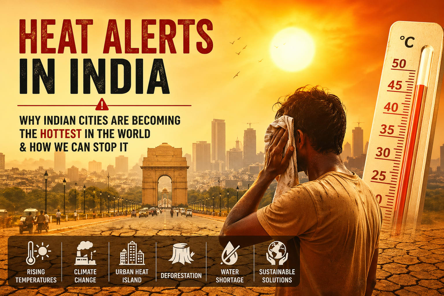
For a country of 1.4 billion people — many of whom depend on agriculture for their livelihoods — the relationship between ENSO and the Indian monsoon is a matter of national importance. India receives most of its annual rainfall (around 70–90%) during the Southwest Monsoon season (June to September). Any disruption to this monsoon has enormous consequences for farming, water supply, electricity generation, and food prices.
El Niño and the Indian Monsoon
There is a well-established statistical relationship between El Niño and weakened Indian monsoons. When the Pacific warms during El Niño, it disrupts the atmospheric circulation patterns that normally drive moisture-laden winds toward the Indian subcontinent. The result is often below-normal rainfall, drought, and reduced crop yields.
Historically, about 60% of severe Indian droughts have occurred during El Niño years. Major droughts in 1965–66, 1972, 1982–83, 1987, 2002, 2009, and 2014–15 were all associated with El Niño events. The 2009 El Niño, for instance, caused India's worst monsoon failure in nearly four decades, leading to a 23% rainfall deficit. Food grain production fell sharply, and food prices spiked significantly.
La Niña and India
La Niña years are generally associated with above-normal monsoon rainfall in India, which is broadly beneficial for agriculture. However, excessive rainfall brings its own problems: flooding in states like Assam, Bihar, Kerala, and Maharashtra; landslides in hilly regions; damage to standing crops from waterlogging; and disruption of infrastructure.
La Niña winters can also bring more intense cold waves to northern India (Punjab, Haryana, Delhi, UP, Rajasthan), sometimes causing significant disruption and health impacts.
Bangladesh, Pakistan, and Sri Lanka
The broader South Asian region is similarly affected. Pakistan, which also depends heavily on monsoon rains, experienced catastrophic flooding during the 2022 La Niña event — over one-third of the country was submerged, killing over 1,700 people and affecting 33 million. Sri Lanka's tea and rubber plantations are highly sensitive to ENSO-related rainfall variability. Bangladesh's low-lying geography makes it especially vulnerable to La Niña-enhanced monsoons, which can cause river flooding affecting millions.
10. ENSO and Climate Change
One of the most pressing questions in climate science today is: How will climate change affect El Niño and La Niña? This is not a simple question, and the answer is still being worked out, but here is what scientists currently know and suspect.
More Intense Events
The overall warming of the Pacific Ocean due to greenhouse gas emissions means that El Niño events have a warmer baseline to work with. The same amount of additional warming from El Niño dynamics is now occurring on top of an already warmer ocean. This means El Niño events may push sea surface temperatures — and their climatic effects — to more extreme levels than in the past.
Research published in leading journals like Nature and Science suggests that the frequency of extreme El Niño events (like 1997–98 and 2015–16) may double under high-emissions scenarios, occurring every 10 years instead of every 20.
Boosting Global Temperature Records
El Niño years already cause temporary spikes in global average temperature — by as much as 0.2–0.3°C above the trend. As the baseline warms due to climate change, El Niño years will increasingly break global temperature records. The years 2016 and 2023 — both El Niño years — are examples of this combined effect breaking temperature records.
Uncertainty in Frequency and Patterns
While scientists are more confident about El Niño becoming more intense, the question of whether ENSO will become more frequent or less frequent is more uncertain. Some models suggest more frequent events; others suggest changes in the type of El Niño (more Modoki-type events). This uncertainty reflects the genuine complexity of the Earth's climate system.
Impacts on Ecosystems
El Niño events already bleach coral reefs by warming ocean waters. As climate change pushes baseline ocean temperatures higher, the thermal stress from El Niño warm anomalies is added to an already stressed system. Scientists warn that by mid-century, even moderate El Niño events could trigger mass bleaching events on every tropical reef in the world — essentially every year.
11. Economic Impact
The economic costs of ENSO events are staggering and affect nearly every sector of the global economy.
Agriculture: This is where ENSO's economic impact is most directly felt. El Niño droughts reduce grain yields in India, Southern Africa, and Australia. La Niña floods destroy crops in Bangladesh and Pakistan. Global commodity prices for wheat, rice, soybeans, and corn fluctuate significantly around major ENSO events. A single severe El Niño drought in India can affect wheat or rice production enough to move global food prices.
Energy: Hydroelectric power generation — which depends on river flow — is highly sensitive to ENSO. El Niño droughts reduce water levels in reservoirs, cutting electricity output in countries like Brazil (which gets over 60% of its power from hydro), Colombia, Peru, and parts of Africa. Conversely, La Niña rains boost hydro production but may cause dam overflow.
Insurance: Major ENSO events are among the costliest insured weather catastrophes. The 1997–98 El Niño caused over $100 billion in total damage, and insurers faced massive claims from floods, fires, droughts, and storms linked to it. Insurance and reinsurance companies closely monitor ENSO forecasts.
Fisheries: El Niño's suppression of cold-water upwelling off Peru devastates the anchovy and sardine fisheries — among the world's most productive. Peru is a major exporter of fishmeal, used in animal feed globally. When Peruvian fisheries collapse, it affects livestock farming industries in Europe, Asia, and North America.
Tourism: El Niño-driven wildfires, droughts, and unusual weather can reduce tourist arrivals in affected regions. Australia, Bali, and the Caribbean all see tourism impacts during ENSO extremes.
A landmark 2023 study estimated that El Niño events cost the global economy an average of $3 trillion over the 5 years following a major event, primarily through reduced economic output in tropical countries. The 1982–83 and 1997–98 events are estimated to have permanently reduced GDP in affected developing nations.
12. Quick Facts & Numbers
years between ENSO cycles on average
peak sea temperature rise during a strong El Niño event
estimated global economic loss from a single major El Niño over 5 years
ocean buoys in the TAO/TRITON array monitoring the Pacific 24/7
of severe Indian droughts historically associated with El Niño years
months — typical duration of a single El Niño or La Niña event
minimum temperature anomaly required to officially declare El Niño or La Niña
typical global average temperature boost from a strong El Niño event
13. Frequently Asked Questions (FAQ)
14. Conclusion
El Niño and La Niña are among the most powerful forces in Earth's climate system. Born from the interaction between the tropical Pacific Ocean and the atmosphere above it, these two phases of the ENSO cycle reach into every corner of the world — bringing floods to some regions and drought to others, warming winters in some countries while intensifying cold snaps elsewhere, fuelling hurricanes in one ocean basin while quieting them in another.
For billions of people — particularly in Asia, Africa, the Americas, and the Pacific — ENSO is not just an interesting scientific phenomenon. It determines whether crops grow or wither, whether rivers flood or dry up, whether electricity grids stay lit or fail, whether food is affordable or scarce. Entire economies, livelihoods, and in extreme cases, lives hang in the balance of each ENSO cycle.
Understanding El Niño and La Niña is not only about understanding climate science. It is about understanding the deep interconnection between the ocean, the atmosphere, and human civilization. The Pacific may seem distant to someone living in Delhi, Nairobi, or London — but through the invisible threads of ENSO, it shapes the rain falling outside their window, the price of food on their plate, and the power running through their home.
As climate change accelerates, ENSO events are likely to become more intense, their impacts more extreme, and the need to predict and prepare for them more urgent than ever. The good news is that we have the science, the monitoring networks, and the forecasting tools to anticipate these events — if we choose to act on the knowledge they provide.
The next El Niño or La Niña is already forming somewhere in the depths of the Pacific. And now, you know exactly what that means.


Discussion
0 comments
No comments yet. Be the first to share your thoughts!